
Anúncios
Waze has revolutionized the way millions of drivers navigate daily, offering real-time traffic updates and intelligent routing that adapts to road conditions instantly.


Whether you’re commuting to work, heading out on a road trip, or simply trying to avoid rush hour chaos, understanding how Waze calculates and suggests routes can transform your driving experience. The app’s community-driven approach combines algorithmic precision with real-world data from millions of users worldwide.
Anúncios
This comprehensive guide explores the intelligent routing system behind Waze, revealing how the app determines the best paths, what factors influence route selection, and how you can optimize your navigation settings to match your personal preferences and driving style.
🚗 How Waze Calculates the Best Routes

Waze employs a sophisticated algorithm that goes far beyond simple distance calculations. The app analyzes multiple data streams simultaneously to determine the optimal path for your journey. Real-time traffic flow, historical patterns, accident reports, road closures, and even weather conditions all feed into the routing engine.
Anúncios
What sets Waze apart from traditional GPS navigation is its dynamic recalculation capability. While conventional systems might stick to a predetermined route, Waze continuously monitors conditions ahead and actively searches for faster alternatives. If a traffic jam suddenly forms on your planned path, the app will automatically suggest a detour before you even encounter the congestion.
The routing algorithm prioritizes estimated arrival time rather than shortest distance. This means Waze might direct you along a slightly longer route if traffic conditions suggest you’ll arrive sooner. The system weighs factors like average speeds on different road types, current congestion levels, and the number of turns or stops required.
User-generated reports play a crucial role in route optimization. When drivers report police presence, hazards, or accidents, this information immediately influences routing decisions for other users. This crowdsourced intelligence creates a self-improving network where every driver contributes to better navigation for the entire community.
🎯 Understanding Route Alternatives and Options
Waze typically presents multiple route options when you enter a destination, each with its own advantages. The primary route appears at the top with an estimated arrival time, while alternatives are displayed with comparative time differences. Understanding what distinguishes these options helps you make informed decisions about which path to choose.
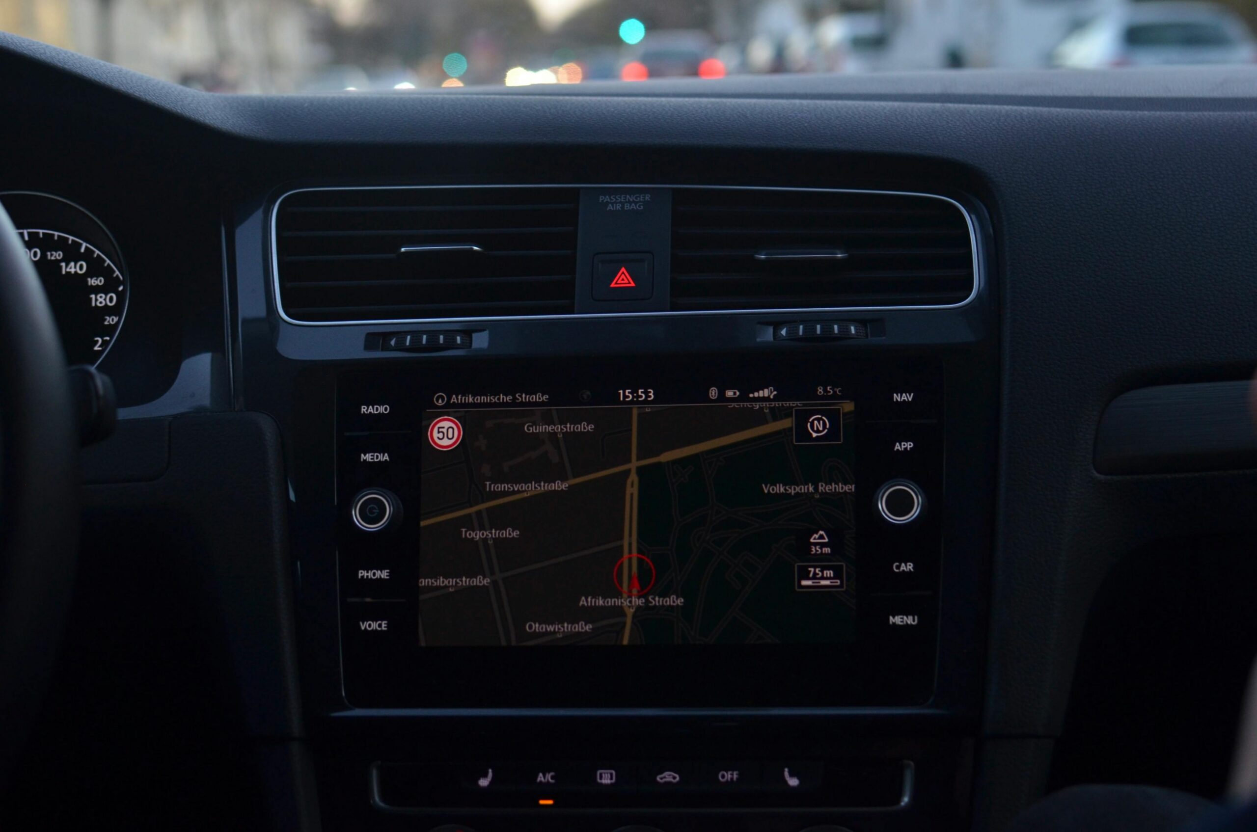
The app color-codes routes based on traffic severity. Green indicates clear roads with minimal delays, while yellow suggests moderate congestion. Orange and red signal heavy traffic that could significantly impact your journey time. These visual cues allow you to assess route conditions at a glance before departing.
Route preferences can be customized in your settings to reflect your driving priorities. If you prefer highways for faster travel, Waze can favor freeways and major arterials. Conversely, if you’d rather avoid tolls or prefer scenic back roads, the app adapts its suggestions accordingly. These preferences don’t override safety or legality but influence how the algorithm weighs different path options.
The app also considers time-of-day patterns when suggesting routes. A path that’s optimal during off-peak hours might be terrible during rush hour. Waze’s historical data recognizes these patterns and adjusts recommendations based on when you’re actually traveling, not just current conditions.
🌟 Advanced Routing Features That Make a Difference
Waze offers several sophisticated features that enhance routing beyond basic navigation. The “Planned Drives” function allows you to set future trips, and the app will notify you about the optimal departure time based on predicted traffic patterns. This proactive approach helps you avoid delays before they happen.
Carpool and HOV lane routing intelligently directs drivers who indicate they’re carpooling toward high-occupancy vehicle lanes. This feature recognizes that access to these express lanes can significantly reduce travel time during congested periods. Simply toggle your passenger count, and Waze adjusts routing to take advantage of available carpool infrastructure.
The motorcycle routing mode optimizes paths specifically for two-wheeled vehicles. This setting accounts for lane-splitting legality in certain regions, narrower passages that cars cannot access, and road types that are more suitable for motorcycle travel. It’s a specialized feature that demonstrates Waze’s commitment to serving diverse transportation needs.
Voice-activated route modifications allow you to request alternative routes hands-free while driving. Simply say “Waze, find an alternate route” to receive new suggestions without touching your device. This safety-focused feature ensures you can adapt your journey without distraction.
📊 Factors That Influence Route Quality
Several variables determine how effective your Waze route will be. Network connectivity plays a vital role since the app requires data to receive real-time updates. In areas with poor cellular coverage, routing relies more heavily on cached data and may not reflect the absolute latest conditions.
The density of Waze users in your area significantly impacts route quality. In metropolitan regions with millions of active users, the data pool is vast and highly accurate. Rural areas with fewer users may have less frequent updates, though the app still provides reliable navigation based on map data and historical patterns.
Time sensitivity affects routing strategies. When you’re running late, Waze becomes more aggressive in seeking faster alternatives, even if they involve more complex maneuvers or less familiar roads. Conversely, when you have time flexibility, the app may prioritize simpler, more predictable routes with fewer turns.
Your driving history influences personalization. Waze learns which routes you prefer and how you typically navigate. If you consistently choose one path over suggested alternatives, the app begins to favor similar routing styles in future trips. This machine learning element creates a navigation experience that becomes more tailored over time.
🛣️ Highway vs. Surface Streets: The Routing Dilemma
One of the most common routing decisions Waze faces is whether to direct you via highways or surface streets. Each option presents distinct advantages depending on circumstances, and the app’s algorithm constantly evaluates which will deliver faster results.
Highways typically offer higher speed limits and fewer interruptions from traffic signals. During off-peak hours, freeway routes almost always provide the quickest journey. However, when accidents or congestion strike, highways can become parking lots with limited exit options for escape.
Surface streets provide flexibility and alternatives. If traffic slows on one road, parallel streets offer detour possibilities. Waze excels at identifying these neighborhood shortcuts that locals might know but visitors would never find. The app’s routing intelligence recognizes when weaving through surface streets will actually beat sitting in freeway traffic.
The decision between highway and surface street routing also depends on distance. For shorter trips, the time required to access and exit a freeway might exceed any speed advantage gained. Waze calculates these access costs and only directs you to highways when the overall journey time benefits.
🔄 Dynamic Rerouting: When and Why It Happens
Dynamic rerouting is perhaps Waze’s most valuable feature, automatically adjusting your path when conditions change. Understanding when and why these reroutes occur helps you trust the app’s guidance even when directions seem counterintuitive.
Rerouting triggers when Waze detects that an alternative path would save significant time—typically at least a few minutes. The app won’t constantly ping-pong you between similar routes for marginal gains, as this creates confusion and wastes fuel. Instead, it waits for substantial improvements before suggesting changes.
Major incidents like accidents, road closures, or severe weather events immediately prompt rerouting calculations. When police close a highway due to an accident, Waze processes this information and guides affected drivers toward alternatives before they reach the closure point.
Some reroutes occur based on traffic pattern predictions. If Waze’s historical data shows that congestion typically develops on your planned route within the next few minutes, the app may proactively suggest an alternative before you actually encounter the slowdown. This predictive capability demonstrates the power of aggregated traffic data.
You can adjust how aggressively Waze reroutes by modifying settings. If you prefer stable directions and dislike frequent changes, you can reduce rerouting sensitivity. Alternatively, if you want every possible time-saving opportunity, you can increase responsiveness to make the app more proactive about suggesting alternatives.
🌍 Cross-Country and Long-Distance Routing
Waze handles long-distance navigation differently than short urban trips. For extended journeys spanning hundreds of miles, the routing algorithm balances immediate conditions with predicted patterns along the entire route. This forward-looking approach ensures you don’t optimize the first hour only to encounter problems later.
Rest stop planning becomes important on long trips. While Waze doesn’t automatically schedule breaks, you can add stops for gas, food, or rest to your route. The app then recalculates to include these waypoints while still optimizing overall travel time. This multi-stop routing ensures your necessary breaks don’t derail your schedule.
Interstate highway systems receive special consideration for long-distance travel. Waze recognizes that major interstates offer consistent speeds, reliable infrastructure, and predictable services. The app balances the slight time savings of complex shortcuts against the simplicity and reliability of staying on major routes for long stretches.
Border crossings and toll roads factor into international or interstate routing decisions. Waze can be configured to avoid toll roads entirely, minimize toll expenses, or simply take the fastest route regardless of cost. For cross-border travel, the app accounts for potential delays at checkpoints and adjusts arrival estimates accordingly.
⚡ Real-Time Updates: The Secret Sauce
Real-time data integration separates Waze from static navigation systems. Every second, the app processes millions of data points from active users, traffic sensors, and partner agencies to maintain an up-to-the-minute understanding of road conditions worldwide.
Speed data from anonymous users creates live traffic flow maps. When thousands of Waze users slow down on a particular road segment, the app recognizes congestion is forming. This crowd-sourced speed monitoring provides earlier and more accurate traffic detection than traditional sensors, which are only installed on major roads.
Incident reports generate immediate routing impacts. A single user reporting a crash can trigger rerouting suggestions for hundreds of approaching drivers within seconds. This rapid information dissemination prevents secondary accidents and minimizes the ripple effects of incidents.
Construction and road closure information comes from both user reports and official sources. Many transportation departments now share their planned work schedules directly with Waze, allowing the app to incorporate upcoming closures into routing days or weeks in advance. This partnership between public agencies and crowdsourced navigation creates a comprehensive information ecosystem.
🎨 Customizing Your Routing Preferences
Waze offers extensive customization options that allow you to tailor routing behavior to match your preferences. Accessing these settings transforms the app from a one-size-fits-all solution into a personalized navigation companion.
Avoid toll roads, ferries, or unpaved roads through simple toggle switches in the navigation settings. These preferences immediately filter out unwanted road types from all route calculations. If you’re on a budget or simply prefer to avoid paying tolls, this setting ensures Waze never directs you to paid routes unless absolutely necessary.
Difficult intersections can be minimized in your routing preferences. If you’re uncomfortable with left turns across busy traffic or complex highway interchanges, Waze can favor routes with simpler maneuvers. This accessibility feature makes navigation less stressful for new drivers or those unfamiliar with an area.
Fuel price integration helps optimize stops on longer journeys. By displaying gas prices at stations along your route, Waze allows you to plan refueling stops where prices are lowest. This feature combines navigation with cost savings, making every trip more economical.
Vehicle type settings adjust routing for cars, motorcycles, or taxis. Each mode applies different routing rules that reflect the unique characteristics and legal privileges of that vehicle type. Taxi mode, for instance, may permit certain restricted zones or bus lanes where available.
🏆 Pro Tips for Getting the Best Routes
Experienced Waze users employ several strategies to maximize routing effectiveness. Starting navigation before you depart allows the app to calculate the optimal route with maximum information. Last-minute route planning might miss recent incidents or traffic developments.
Checking alternative routes manually before departing gives you options. While Waze automatically selects the fastest route, viewing alternatives helps you make informed decisions if you have preferences about certain roads or areas to avoid. You might choose a slightly slower route that uses roads you find more comfortable.
Contributing reports improves routing for everyone, including yourself. When you report hazards, police, or traffic jams, you’re feeding the system that creates better routes. Active participation in the Waze community creates a positive feedback loop where everyone benefits from shared information.
Update the app regularly to access the latest routing improvements. Waze continuously refines its algorithms and adds new features. Running outdated versions means missing out on optimization enhancements and new data sources that improve route quality.
Trust the app’s suggestions, especially when they seem unusual. Waze’s routing might direct you through neighborhoods or side streets you’ve never considered, but these recommendations are based on comprehensive data analysis. Often, these unexpected routes save significant time compared to traditional paths.
🔐 Privacy and Data Considerations in Routing
Understanding how Waze uses your data to create routes helps you make informed decisions about privacy settings. The app collects location information to provide navigation services and contribute to the community traffic database. However, this data is anonymized and aggregated to protect individual privacy.
You can navigate invisibly by activating ghost mode, which prevents other users from seeing your location on the map. This setting doesn’t affect routing quality since the app still uses your anonymous speed and location data to inform traffic conditions without revealing your identity.
Data usage for route updates requires cellular connectivity, which has privacy and cost implications. On unlimited data plans, this isn’t a concern, but metered connections might accumulate charges during extensive use. Wi-Fi pre-loading of routes can minimize data consumption by downloading map information before departure.
Location history enables personalized routing based on your driving patterns. While this improves navigation suggestions, some users prefer to disable location tracking when not actively navigating. Waze allows you to control these settings based on your comfort level with data collection.
🚀 Future of Waze Routing Technology
Waze continues evolving with emerging technologies that promise even smarter routing. Artificial intelligence and machine learning enhancements allow the app to predict traffic patterns with increasing accuracy, anticipating congestion before it fully develops.
Electric vehicle integration represents a growing focus area. As EV adoption increases, Waze is developing routing that accounts for charging station locations, battery range, and elevation changes that impact energy consumption. This specialized routing ensures electric vehicle drivers can navigate confidently without range anxiety.
Integration with smart city infrastructure creates opportunities for unprecedented routing precision. As cities deploy connected traffic signals and intelligent transportation systems, Waze can incorporate signal timing data to optimize routes down to individual intersections, potentially timing arrivals to catch green lights.
Autonomous vehicle preparation positions Waze as a potential navigation system for self-driving cars. The app’s comprehensive real-time data and community reporting could provide crucial situational awareness for automated driving systems, bridging the gap between GPS navigation and full autonomy.
✨ Making Every Journey Your Best Route
Mastering Waze routing transforms daily driving from a stressful chore into an optimized experience. By understanding how the app calculates routes, what factors influence its suggestions, and how to customize settings to match your preferences, you unlock the full potential of community-powered navigation.
The best route isn’t always the shortest distance or even the fastest time—it’s the path that best fits your specific circumstances, preferences, and comfort level. Waze provides the intelligence and flexibility to find that optimal route for every journey, whether you’re commuting five miles across town or road-tripping five hundred miles across states.
Remember that routing excellence comes from the combination of sophisticated algorithms and community participation. Every report you contribute, every route you complete, and every traffic pattern you help identify makes the system smarter for millions of drivers worldwide. This collective intelligence creates navigation solutions that no individual driver or traditional GPS could achieve alone.
Your next journey begins with a destination and ends with an arrival, but the route between determines your experience. With Waze’s intelligent routing guiding your way, you’re not just following directions—you’re navigating with the collective wisdom of millions of drivers who’ve traveled these roads before you, all working together to make every route the best possible path forward.